Drone Photography in Archaeology: Discovering Hidden Historical Sites
In the evolving field of archaeology, traditional methods are being expanded by advanced technologies, including
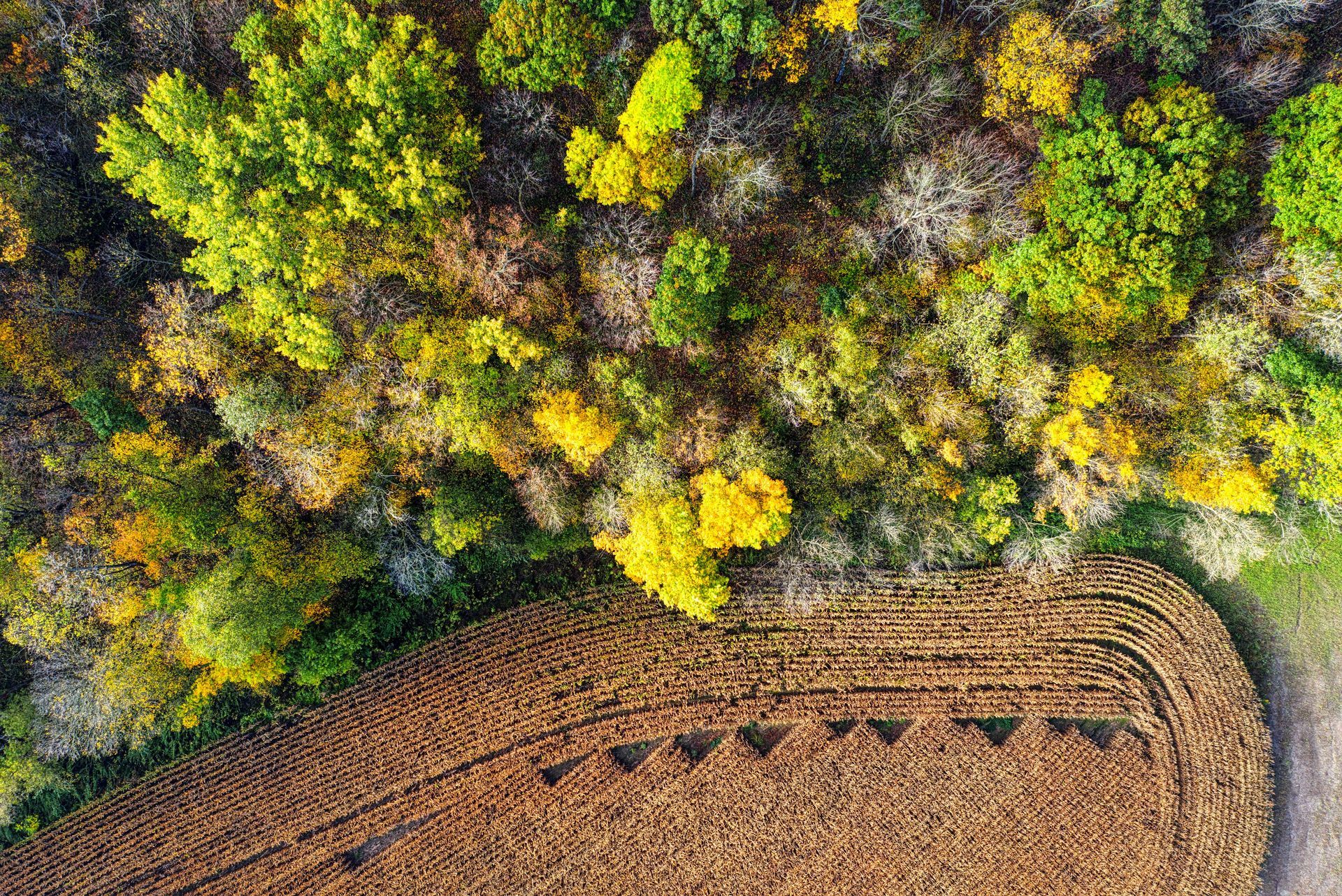
drone photography. This transformative approach has redefined how archaeologists and historians uncover and study ancient sites. Using aerial perspectives, drone photography offers a unique point of view that ground-level operations cannot match. This blog explores how drone photography is revolutionising the discovery of hidden historical sites, enhancing the accuracy of archaeological research, and providing unprecedented insights into our past.
The Advantages of Drone Photography in Archaeology
Drone photography is proving to be a game-changer in archaeological investigations for several reasons. It allows researchers to access and document hard-to-reach areas with minimal disturbance to the site. Drones can quickly cover large areas, providing archaeologists with detailed aerial images that are crucial for identifying and mapping archaeological features.
In addition, the technology supports the creation of precise 3D models and topographical maps, which are invaluable in planning excavation strategies and preserving historical data. This capability is particularly useful in complex archaeological sites where detailed spatial analysis is necessary.
Case Studies Highlighting the Impact of Drone Photography
Several successful applications of aerial photography in archaeology underscore its transformative impact. For instance, in the dense forests of Cambodia, drones have revealed multiple undiscovered temples near the famous Angkor Wat complex. Similarly, in Mexico, drones equipped with thermal imaging cameras have identified ancient Mayan farms buried under thick vegetation, offering new insights into pre-Columbian agricultural practices.
In the UK, drone technology has been instrumental in several archaeological discoveries:
- Stonehenge Landscape: Drones have been used to survey the landscape around Stonehenge, revealing hidden pits and burial mounds. These findings have provided new insights into the prehistoric use of the area and the people who engineered these monumental structures.
- Hadrian's Wall: Archaeologists have utilised drones along parts of Hadrian's Wall to uncover previously unrecorded Roman settlements and fortifications. This has allowed for a better understanding of the frontier system that once defined the edge of the Roman Empire.
- The Lost Gardens of Heligan: In Cornwall, drone surveys have helped map out the intricate layouts of these historical gardens, which had been overgrown and lost after the First World War. The aerial images captured by drones guided the restoration process, helping to accurately restore the gardens to their former glory.
These examples highlight how drones can provide significant advantages in archaeological research, offering a new dimension of discovery and documentation. From thermal imaging to LiDAR (Light Detection and Ranging), drones are equipped with technology that can penetrate foliage, soil, and other barriers to reveal secrets that have been buried for millennia.
Challenges and Ethical Considerations
While the benefits are significant, drone use in archaeology poses specific challenges, including privacy concerns, potential damage to sensitive sites, and the need for proper regulatory compliance. Ethical considerations must also be addressed, ensuring that
aerial photgraphers in archaeological contexts respects both the cultural significance of sites and the surrounding environment.
The Future of Drone Photography in Archaeology
The integration of
drone service in archaeology is expected to grow, with future advancements likely to enhance the efficiency and scope of archaeological surveys. Enhanced sensor technology, improved data processing, and more user-friendly drone platforms could further revolutionise this field.
Aerial p is reshaping the field of archaeology, providing a bird's-eye view that reveals historical secrets like never before. As we continue to harness this technology, we can expect many more discoveries that will fill in the gaps of human history.
For archaeologists looking to leverage this technology, partnering with experienced and reliable experts like Aerial Photography Manchester ensures high-quality results. Our expertise in aerial photography makes us the premier choice for professionals seeking precise and respectful engagement with archaeological sites.
Check out our latest GBP update about drone photography in archeology.